Interactive Visualization for Urban Design and Data
We work with urban designers and planners to engage with communities using data-driven tools for sharing and collaborative visioning.
Our Mission
We aim to radically improve quality of life in cities with better tools for planning and collaborating around sustainable land use and transportation.
Our Services
Community Engagement Portal
A quick-launch community engagement portal to review and act on public input.
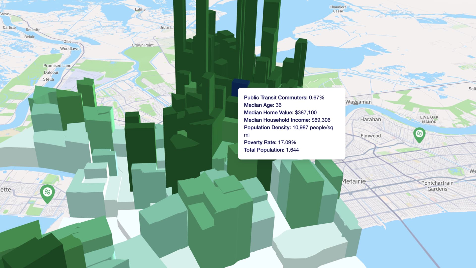
Interactive GIS Dashboard
The quickest path from raw GIS to spatial insights, with zero technical overhead.
GIS + Engagement Suite
Double the insights with map-based comments and GIS layers on the same map.
Featured Projects

Claiborne Reborn
An EPA-funded project studying the public health impact of the Claiborne Expressway, involving community engagement and urban design recommendations.

Syracuse Community Grid Vision Plan
A comprehensive vision plan for Syracuse's future after removing the I-81 expressway, focusing on reconnecting communities and improving quality of life.

